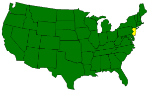
The Geography of New Jersey
| Longitude / Latitude | Longitude: 73° 53' 39"W to 75° 35'W Latitude: 38° 55'N to 41° 21' 23"N |
| ||
| Length x Width | New Jersey is about 150 miles long and 70 miles wide. | |||
| Geographic Center Explanation | The geographic center of New Jersey is located in Mercer County, 5 miles SE of Trenton. Longitude: 74° 33.5'W Latitude: 40° 4.2'N | |||
| Borders | New Jersey is bordered by New York on the north and by the Delaware Bay and Atlantic Ocean on the south. On the east, New Jersey is again bordered by the Atlantic Ocean. On the west, New Jersey is bordered by Delaware Bay and Pennsylvania. | |||
| Total Area | New Jersey covers 8,722 square miles, making it the 47th largest of the 50 states. | |||
| Land Area | 7,419 square miles of New Jersey are land areas. | |||
| Water Area | 1,303 square miles of New Jersey are covered by water. | |||
| Highest Point | The highest point in New Jersey is aptly named High Point at 1,803 feet above sea level. | |||
| Lowest Point | The lowest point in New Jersey is at the Atlantic Ocean; sea level. | |||
| Mean Elevation | The Mean Elevation of the state of New Jersey is 250 feet above sea level. | |||
| Major Rivers | Delaware River, Hudson River | |||
| Major Lakes | Lake Hopatcong http://www.netstate.com/states/geography/nj_geography.htm | |||
Немає коментарів:
Дописати коментар